I drove a few kilometres from the campground to the Brambuk Cultural Centre – an Aboriginal complex of Info Centre, Café, gift shop, cultural display of photos and text depicting the two indigenous groups that lived here before European settlers came. There was a separate building also with photos, text and videos showing the history of the indigenous people since the coming of European settlers.
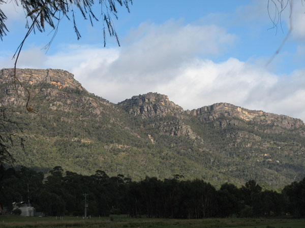
I left the Centre and drove along Mount Zero Road again further than the first time when I drove to the quarry. The corrugations were so bad, every nut and bolt in the Subaru must have been put to the test, not to mention my teeth. I drove slowly and tried to keep one set of wheels off the road which was the only place there were no corrugations.
At one stage I straddled a stumpy tail lizard crossing the road at the mind blowing speed of a snail on a bad day.
At another time, I stopped the car just in time to avoid running over a snake. It was about one and a half metres long and beautiful. I backed up and sat and watched it glide across the road like a ribbon of brown silk in the sunshine.
Further on, an emu crossed the road, trotting confidently across in front of me, fully confident that this was its territory. Not long after, I rounded a curve to see a kangaroo sitting in the middle of the road watching me approach. Finally, it turned and hopped along the road with me following and eventually it veered off into the bush.
Some kilometres further on, I turned off the road to a car park, left the Subaru and took a gently sloping path up the mountain to see the rock art of Gurgan Manja. The path got steeper and the ground underfoot turned from sand to rock.
The climb was not difficult and I reached the rocky overhang which was securely protected from vandals by a solid mesh fence. Incongruous in the ancient bush setting but sadly necessary. The rock art consisted mainly of small red hand prints and, while not in any way spectacular to look at, was an electrifying glimpse into a very distant past.
There are several rock art sites in the Grampians, five of them being open to the public.
From Guran Manja, I found a six-kilometre short cut to the Western Highway and drove a much longer route back to camp to avoid the bone-shaking experience of returning along Mount Zero Road.
The next day, I drove along the edge of the now full Lake Bellfield Reservoir, turned into a bush road, parked and headed along the track to see Silverband Falls. The sign at the beginning of the track said it was an easy walk with some “rock hopping” and much flood damage.
And so it was. The rock hopping turned out to be some thoughtfully-placed flat boulders across the creek so no feet got wet in the process. The flood damage consisted of the debris of enormous uprooted trees and boulders washed along the creek bed. A walking track had been constructed through the rubble so it was still possible to reach the falls. They were aptly named as they are a delicate single silver band of falling water.
 |
| Before the flood of January 2011 |
 |
| After the flood |
 |
| After the flood |
 |
| Silverband Falls, Grampians |
The Grampians and the people who live there have made a remarkable recovery from the floods of January. There are still several roads that are closed due to rock slides, but the clean up has been amazing. While the flooding of parts of Victoria was overshadowed by the enormity of the simultaneous floods in Queensland, the damage is equally devastating to the individuals involved. The recovery is inspiring.
The Grampians are still teaming with wildlife. Check out the Halls Gap Floor Show on a previous post. The Tardis was often surrounded by Kangaroos and visited by parrots and cockatoos and other birds. |
| Just dropped in |
 |
| Mother with joey in her pouch |
 |
| Just brilliant |


